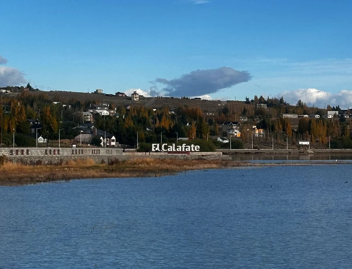
Trekking in El Chaltén 2026: Complete Technical Guide to the 14 Self-Guided Trails
Introduction
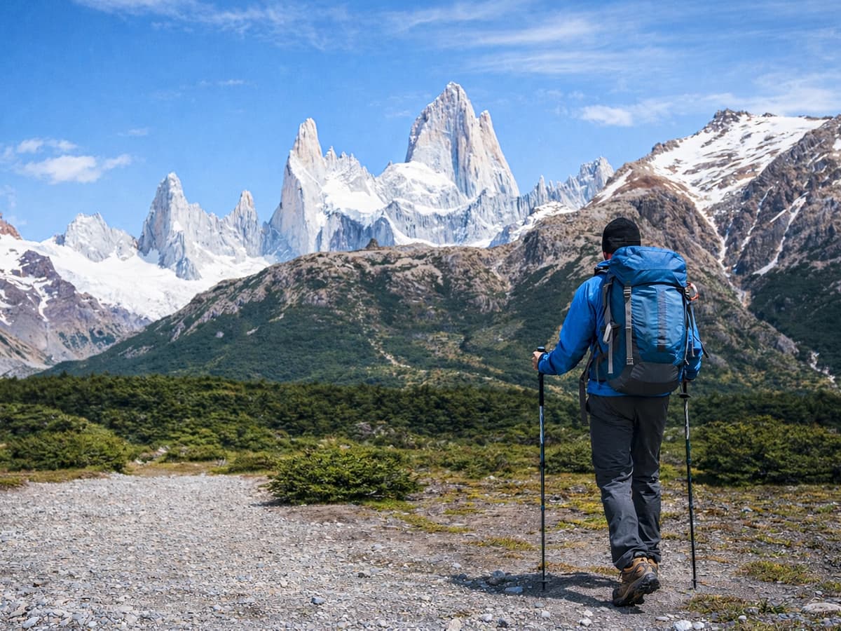
El Chaltén is the National Trekking Capital of Argentina by Law 27.055 (sanctioned December 3, 2014, promulgated January 2015). Located at the northern tip of Los Glaciares National Park (Santa Cruz province, Argentine Patagonia), this small mountain town offers something unique in the world: 14 self-guided trekking trails accessible directly from the urban area, without the need for an authorized guide or special transport for the main circuits.
The town was founded on October 12, 1985, as an act of territorial sovereignty in the context of border disputes with Chile. Its strategic location within a protected area administered by the National Parks Administration (APN) gives it the advantage that the trails literally begin at the end of the town's streets.
The trail network is structured around two world-class granite massifs:
- Mount Fitz Roy (3,405 m asl): known by the Aonikenk (Tehuelche) people as "Chaltén", a term meaning "smoking mountain" or "mountain that smokes", due to the clouds that crown its summit. First ascent: 1952, by Lionel Terray and Guido Magnone.
- Cerro Torre (3,102 m asl): considered one of the most extreme technical challenges in world alpinism due to its vertical granite walls and the summit ice mushroom. First recognized ascent: 1974, Italian expedition.
Comparative Table: The 14 Trekking Trails in El Chaltén
| # | Trail | Category | Difficulty | Duration | Distance | Elevation Gain | Kid-Friendly | Fee Required |
|---|---|---|---|---|---|---|---|---|
| 1 | Mirador Margarita | Short walk | Low | 2 h | 4 km (round trip) | N/A | ✅ Yes | NP (online) |
| 2 | Los Cóndores y Las Águilas | Short walk | Low | 2 h | 4–6 km | 100 m | ✅ Yes | NP (online) |
| 3 | Chorrillo del Salto | Short walk | Low | 3 h | 7 km | Flat (0 m) | ✅ Yes | NP (online) |
| 4 | Mirador del Torre | Half-day | Low | 3–4 h | 7 km | 150–180 m | ⚠️ Possible | NP (online) |
| 5 | Laguna Capri | Half-day | Low | 4–5 h | 8 km | 350 m | ⚠️ Possible | NP (online) |
| 6 | Laguna Torre | Full-day | Low | 7–8 h | 19 km | 250 m | ⚠️ Teenagers | NP (online) |
| 7 | Laguna de los Tres | Full-day | Medium | 8–9 h | 25 km | 750 m | ❌ No | NP (online) |
| 8 | Loma del Pliegue Tumbado | Full-day | Medium | 7–8 h | 21 km | 850–1,100 m | ❌ No | NP (online) |
| 9 | Piedra del Fraile | Río Vueltas Valley | Medium | 4–6 h | 13 km | ~262 m | ⚠️ Possible | Private |
| 10 | Laguna Azul | Río Vueltas Valley | Low | 2 h | 5 km | 100–123 m | ✅ Yes | Private |
| 11 | Laguna Diablo | Río Vueltas Valley | Low | 5–6 h | 14 km | 400 m | ⚠️ Possible | Private |
| 12 | Glaciar Piedras Blancas | Río Vueltas Valley | Low | 4–5 h | 8 km | 230 m | ⚠️ Possible | NP (online) |
| 13 | Glaciar Huemul | Lago del Desierto | Low | 2 h | 4 km | ~200 m | ⚠️ Possible | USD 11 |
| 14 | Hito Limítrofe Laguna Larga | Lago del Desierto | Moderate | 4–5 h | 9.5 km | 220 m | ⚠️ Possible | Free |
APN Note: Elevation gain data comes from the official trail brochure for the North Zone of Los Glaciares National Park (APN, Dec. 2017). Fees for private areas must be confirmed directly for the 2025–2026 season.
Detailed Technical Sheets
CATEGORY 1: Short Walks
1. Mirador Margarita
- Difficulty: Low
- Total duration: 2 hours
- Distance: 2 km (one way) / 4 km (round trip)
- Elevation gain: Not officially published
- Season: All year
- Start: End of Av. San Martín or Llao Llao street
- Kid-Friendly: Yes
- NP Fee: Yes — North Zone online ticket
From the start of the Cerro Torre trail, the path enters the Fitz Roy river valley and in a few minutes reaches a gorge with panoramic views towards the Adela range, Cerro Torre, Cerro Solo, and the Fitz Roy massif. From the viewpoint, Margarita waterfall can be seen on the other side of the river.
What you see: Margarita waterfall, Fitz Roy river, Fitz Roy massif, Cerro Torre, Cerro Solo, Adela range.
Recommendations: The wind can be strong, especially between October and March. Bring a windbreaker even on sunny days.
2. Los Cóndores y Las Águilas
- Difficulty: Low
- Total duration: 2 hours
- Distance: 4 km (Mirador Los Cóndores) / 6 km (Mirador Las Águilas)
- Elevation gain: 100 m — Source: official APN brochure
- Season: All year
- Start: Ceferino Fonzo Visitor Center
- Kid-Friendly: Yes
- NP Fee: Yes — North Zone online ticket
The Mirador Los Cóndores offers a complete aerial view of the town and the Río de las Vueltas Valley. A marked fork leads to Mirador Las Águilas (an additional 15 minutes), with a perspective to the south: Lago Viedma, Cerro Huemul, and the infinite steppe.
What you see: El Chaltén from above, Río de las Vueltas Valley, Lago Viedma, Fitz Roy and Cerro Torre massifs, frequent sighting of Andean condors (Vultur gryphus).
Recommendations: The sunset hike offers the best light play on the massifs.
3. Chorrillo del Salto
- Difficulty: Low
- Total duration: 3 hours
- Distance: 7 km (round trip)
- Elevation gain: Flat — 0 m (Source: official APN brochure)
- Season: All year
- Start: End of Av. San Martín — marked detour at 2 km
- Destination: Chorrillo del Salto waterfall (20 m high)
- Kid-Friendly: Yes — flat terrain, ideal for young children
- NP Fee: Yes — North Zone online ticket
The trail runs parallel to Provincial Route 41, passing through Lenga forest. The terrain is almost completely flat, the most accessible in the system. In winter, the waterfall can freeze completely, forming an ice column.
What you see: Chorrillo del Salto waterfall (20 m), Lenga forest (Nothofagus pumilio). In winter: frozen waterfall.
Recommendations: In winter, check with Park Rangers if the waterfall is active or frozen.
CATEGORY 2: Half-Day Trails
4. Mirador del Torre
- Difficulty: Low
- Total duration: 3–4 hours
- Distance: 7 km (round trip)
- Elevation gain: 150–180 m
- Season: All year
- Start: End of Av. San Martín / Llao Llao street
- Kid-Friendly: Possible
- NP Fee: Yes — North Zone online ticket
The trail shares the route with the Laguna Torre trek. After passing Mirador Margarita, it continues up the valley until it reaches Mirador Del Torre, with a closer and higher perspective of Cerro Torre.
What you see: Cerro Torre, Cerro Solo, Adela range, Standhardt needle, Bifida needle, Fitz Roy river.
Recommendations: The wind intensifies as you advance into the valley; bring a windbreaker.
5. Laguna Capri
- Difficulty: Low
- Total duration: 4–5 hours
- Distance: 8 km (round trip)
- Elevation gain: 350 m — Source: official APN brochure
- Maximum altitude: ~900 m asl
- Season: All year
- Start: End of Av. San Martín
- Kid-Friendly: Possible
- Campsite: Campamento Capri (with prior reservation — 2025–2026 season)
- NP Fee: Yes — North Zone online ticket
It shares the first kilometer with the Laguna de los Tres trail. The lagoon, surrounded by native Lenga forest, offers a reflection of the Fitz Roy massif in its calm waters on clear mornings.
What you see: Mount Fitz Roy and peripheral needles (Poincenot, Rafael Juárez, Saint-Exupéry) reflected in the lagoon.
Recommendations: Recommended departure before 08:00 AM for morning photography.
CATEGORY 3: Full-Day Trails
6. Laguna Torre
- Difficulty: Low
- Total duration: 7–8 hours
- Distance: 19 km (round trip)
- Elevation gain: 250 m — Source: official APN brochure
- Season: All year
- Start: End of Av. San Martín / Llao Llao street
- Kid-Friendly: Teenagers in good physical condition
- Campsite: Campamento De Agostini (with prior reservation — 2025–2026 season)
- NP Fee: Yes — North Zone online ticket
Classic valley route with little elevation gain. The end of the route reaches the natural amphitheater formed by Cerro Torre (3,102 m asl), Cerro Solo, and the Adela range, with the lagoon fed by the Glaciar Grande del Torre and blue icebergs floating.
What you see: Cerro Torre, Glaciar Grande del Torre, icebergs, Standhardt needle, Bifida needle.
Special Phenomenon: The Venturi effect of the valley generates extremely strong winds at the lagoon. Wearing windbreaker layers is imperative.
7. Laguna de los Tres
- Difficulty: Medium
- Total duration: 8–9 hours
- Distance: 25 km (round trip)
- Total elevation gain: 750 m (one way) — Source: official APN brochure
- Critical section: Last kilometer: +400 m of elevation gain over rocky terrain (~1 hour)
- Maximum altitude: ~1,170 m asl
- Season: All year
- Kid-Friendly: Not recommended
- Campsite: Campamento Poincenot (with prior reservation — 2025–2026 season)
- NP Fee: Yes — North Zone online ticket
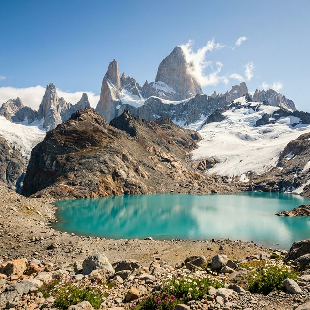
The most iconic trek in El Chaltén. The final section climbs +400 meters in just 1 km over rocky and steep terrain, requiring approximately one hour of hands-free ascent.
What you see: Mount Fitz Roy (3,405 m asl) from its eastern base, Poincenot needles (3,002 m), Rafael Juárez, Saint-Exupéry. Laguna Sucia (optional, 5 min more), fed by the Supercanaleta Glacier.
Critical Recommendations:
- Start before 08:00 AM
- The final section requires hands-free (do not use poles on the rocky ascent)
- Bring a headlamp
- High-factor sunscreen
8. Loma del Pliegue Tumbado
- Difficulty: Medium
- Total duration: 7–8 hours
- Distance: 21 km (round trip)
- Elevation gain to viewpoint: 850 m
- Elevation gain to summit: 1,100 m
- Viewpoint altitude: ~1,500 m asl
- Summit altitude: ~1,780 m asl
- Season: All year (check snow conditions)
- Start: Ceferino Fonzo Visitor Center
- Kid-Friendly: Not recommended
- NP Fee: Yes — North Zone online ticket
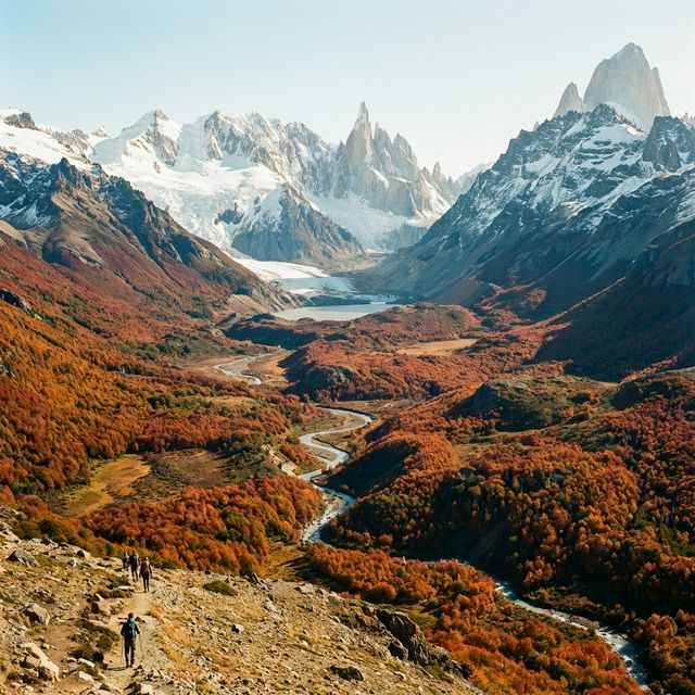
The only self-guided trail in El Chaltén with 360-degree panoramic views: Fitz Roy, Cerro Torre, Río de las Vueltas Valley, Lago Viedma, and the Patagonian steppe simultaneously. In the high-altitude section, it's possible to find Cretaceous marine fossils.
Critical Recommendations:
- Area extremely exposed to wind and sudden weather changes
- Check trail status with Park Rangers
- Start at first light
CATEGORY 4: Río de las Vueltas Valley
9. Piedra del Fraile
- Difficulty: Medium
- Total duration: 4–6 hours
- Distance: 13 km (round trip)
- Elevation gain: ~262 m
- Season: October–April
- Start: Bridge over the Eléctrico river (RP 41, ~17 km from El Chaltén)
- Access: Private area — verify conditions and costs
- Kid-Friendly: Possible
- Fee: Private — check current price
Route through a wide glacial valley with a lateral perspective (north face) of the Fitz Roy massif. The Piedra del Fraile refuge serves as a resupply and camping point for alpinists heading towards Glaciar Marconi.
Recommendations: Transfer needed to the start (taxi/remis from El Chaltén, verify current price).
10. Laguna Azul — Estancia Los Huemules
- Difficulty: Low
- Total duration: 2 hours
- Distance: 5 km
- Elevation gain: 100–123 m
- Area: Los Huemules Ranch Private Reserve (17 km from El Chaltén)
- Season: All year — Entry: 09:00 AM–04:00 PM
- Kid-Friendly: Yes — children under 16 free of charge
- Prior reservation: Mandatory (limited daily capacity)
- Fee: Check 2025–2026 season price at loshuemules.com.ar
- Pets: Not allowed
The private Los Huemules reserve protects the habitat of the huemul (Hippocamelus bisulcus), an endangered native deer. Laguna Azul has a turquoise color; 500 m further, Laguna Verde offers a unique perspective of the north face of Fitz Roy.
Recommendations: Mandatory advance reservation. Can be combined with Laguna Diablo on the same day.
11. Laguna Diablo — Estancia Los Huemules
- Difficulty: Low (long)
- Total duration: 5–6 hours
- Distance: 14 km (round trip)
- Elevation gain: 400 m
- Area: Los Huemules Ranch Private Reserve
- Season: All year — Entry limit: 01:00 PM
- Kid-Friendly: Possible — children under 16 free of charge
- Prior reservation: Mandatory
- Fee: Check 2025–2026 season price at loshuemules.com.ar
- Pets: Not allowed
The trail crosses the Río Diablo Valley, traversing suspension bridges through dense Nothofagus forests. It culminates at Laguna Diablo with direct views of Glaciar Cagliero.
12. Glaciar Piedras Blancas
- Difficulty: Low
- Total duration: 4–5 hours
- Distance: 8 km (round trip)
- Elevation gain: +230 m — Source: official APN brochure
- Season: October to May
- Start: Eléctrico river bridge — RP 41 (~17 km from El Chaltén)
- Kid-Friendly: Possible
- NP Fee: Yes — North Zone online ticket (from the NP gate)
The final viewpoint offers frontal views of Glaciar Piedras Blancas (~2,000 m asl), with seracs, crevasses, and seasonal icefalls. The first section crosses private property with conditional free access.
Recommendations: Transfer to the start requires planning (remis or private vehicle).
CATEGORY 5: Lago del Desierto
13. Glaciar Huemul
- Difficulty: Low
- Total duration: 2 hours
- Distance: 4 km (round trip)
- Elevation gain: ~200 m
- Season: September to May
- Start: Southern tip of Lago del Desierto (37 km from El Chaltén)
- Kid-Friendly: Possible — children under 10 free of charge
- Fee: USD 11 per adult — confirm validity
From the parking lot at the Southern Tip, the trail ascends through Lenga forest to Laguna Huemul, fed by the eponymous hanging glacier.
What you see: Glaciar Huemul, Laguna Huemul, north face of Fitz Roy, Lago del Desierto.
14. Hito Limítrofe — Laguna Larga
- Difficulty: Moderate
- Total duration: 4–5 hours
- Distance: 9.5 km (round trip)
- Elevation gain: +220 m
- Season: October to April
- Start: Gendarmería Nacional facilities — Northern tip of Lago del Desierto
- Mandatory registration: Yes — present documentation at Gendarmería before starting
- Fee: Free
The most remote trail in the system. The final landmark marks the Argentina–Chile international border, with Fitz Roy visible 40 km away.
What you see: Lago del Desierto, Laguna Larga, Bosque and Vespignani ranges, Argentina–Chile border marker.
Recommendations: The marshland can create intense mud; footwear with deep grip is essential. Registration with Gendarmería is mandatory due to border protocol.
Regulations and Fees 2026 — Los Glaciares National Park North Zone
Access System
Starting from the 2024–2025 season, the APN implemented access fees in the North Zone. The system remains in effect for 2025–2026. Access gates: Los Cóndores, Cerro Torre, Fitz Roy Base, and Río Eléctrico.
- Payment exclusively online or via QR at the gates
- Cash is not accepted at access points
- Ticket purchase: ventaweb.apn.gob.ar
Reference Fees (verify validity before traveling)
| Category | 2024–2025 Reference |
|---|---|
| Foreigners | AR$ 45,000 / day |
| National Residents | AR$ 15,000 / day |
| National retirees and pensioners | Exempt |
| Children 0–5 years | Exempt |
| People with disabilities | Exempt |
| Local residents | Exempt |
Fees are updated periodically. Verify at argentina.gob.ar/parquesnacionales before your trip.
Promotional Passes
- 2nd Day Discount: 50% discount within 72 hours of first entry
- 3-day FlexiPass: check current price in the APN online system
Campsites (2025–2026 Season)
Since the 2024–25 season, campsites require prior reservation and are no longer free. This applies to: De Agostini (Laguna Torre), Capri, and Poincenot (Laguna de los Tres).
Rules:
- Gas stoves only (fire prohibited)
- Zero Waste Policy — everything leaves with the visitor
- No provisions available at any campsite
General Park Rules
| Rule | Detail |
|---|---|
| Fire | Prohibited throughout the park |
| Pets | Not allowed on trails |
| Drones | Prohibited throughout the protected area |
| Waste | "Zero Waste" policy |
| Winter trails (May–Sept.) | Poles and crampons mandatory according to APN |
| Winter registration | Mandatory at the Information Center |
How to Get to El Chaltén from El Calafate
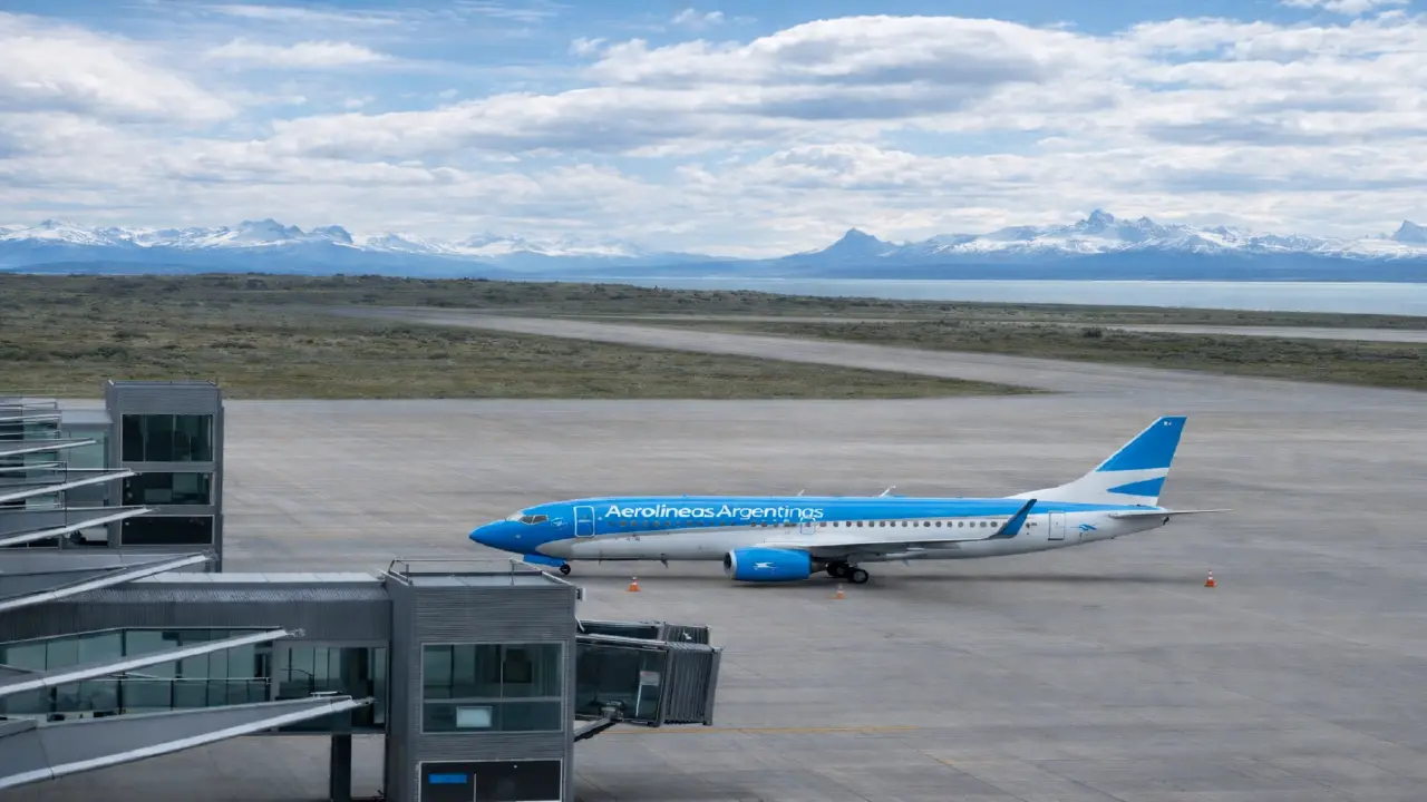
El Chaltén does not have an airport. The main access is from the Comandante Armando Tola International Airport (FTE) in El Calafate.
| Data | Information |
|---|---|
| Distance | ~215 km (RN 40 and RP 41) |
| Travel time | ~3 hours |
| Companies | Chaltén Travel, CalTur, TAQSA/Marga |
| Frequency | Daily all year; high season: up to 27 departures/day |
| Schedules | 08:00 AM – 08:00 PM in high season |
| Private transfer | From approximately USD 200 |
Climate and Seasonality
The climate is Andean-Patagonian transitional: high variability and wind as the dominant variable. The general rule: there is no bad weather, only inadequate gear.
| Month | Avg. Temp. (°C) | Precipitation (mm) | Observations |
|---|---|---|---|
| January | 12.9 | 58 | Peak season; daylight until 10:00 PM |
| February | 12.5 | 62 | Maximum international tourism |
| March | 10.0 | 70 | Start of autumn; Lenga tree colors |
| April | 8.0 | 91 | Best autumn photography; wind decreases |
| May | 5.0 | 85 | Start of winter; mandatory equipment |
| June | 3.0 | 75 | Full winter; many services close |
| July | 2.6 | 73 | Minimum temperature; frequent snow |
| August | 3.5 | 68 | Thaw; muddy trails |
| September | 5.5 | 70 | Spring; very strong winds |
| October | 8.0 | 65 | Season start; possible snowfalls at high altitude |
| November | 10.0 | 60 | Long days; possible snowfalls |
| December | 12.0 | 55 | High season; 16 hours of daylight |
Best time: November to March (southern hemisphere summer). Photographers prefer April–May for autumn colors and less wind.
Recommended Equipment
Layering System
| Layer | Function | Material |
|---|---|---|
| Layer 1 — Base | Moisture-wicking | Merino wool or technical synthetic. Never cotton. |
| Layer 2 — Insulation | Thermal retention | High-density fleece |
| Layer 3 — Protection | Barrier against wind and rain | Waterproof jacket with technical membrane (Gore-Tex or equivalent) |
- Trekking boots with waterproof membrane and Vibram sole
- Poles highly recommended; mandatory in winter according to APN
- Crampons mandatory in winter season (May–September)
- Headlamp, 50+ sunscreen, physical map
- Water: minimum 2 liters (can be refilled from mountain streams)
- Waste bags (Park's Zero Waste policy)
Visitation Statistics
- 2023: 803,076 total visitors in Los Glaciares National Park — annual historical record
- 2024: 731,182 visitors (9.5% year-over-year decrease)
- 2025: Data pending official publication
- High season profile: ~80% of visitors in El Chaltén are foreign tourists
- January 2024: 123,212 entries — monthly historical record
Sources: elchalten.com, Official Trail Brochure North Zone Los Glaciares National Park (APN, Dec. 2017), argentina.gob.ar/parquesnacionales, loshuemules.com.ar, Law 27.055/2014 Last updated: February 2026